
 MT. TAMALPAIS SUNDAY HIKE: INTERNATIONAL & NORTHSIDE TRAILS
Leader: Ken Robin
Leader Email: k.robin@sbcglobal.net
Leader Phone: 510-985-0804
Meeting Date and Day: Saturday, September 24, 2023
SF Meeting Location (ONLY IF you've arranged for a ride in SF): Whole Foods; 2001 Market St. @ Dolores (on the Dolores St. side); parking on the street or below.
East Bay Meeting Location: ONLY IF you've arranged for a ride) Rockridge BART, bottom of escalator.
Meeting Time: (either location): 9:00 AM, departing shortly afterwards
Rating: Level-3
Mileage: 7 miles
Elevation Gain: 1000'
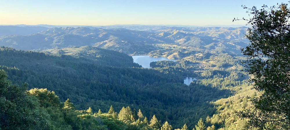
Description: The hike will explore shady, wooded trails on Mt. Tam's northside. We'll start on Ridgecrest Blvd above the International trail, take the Northside trail to Potrero Meadow, and then take a variety of streamside trails to High Marsh trail. We'll eventually reach Colier Spring, one of the prettiest spots on Mt. Tam. The unofficial midget trail will lead us back to the cars. There are two short steep sections, each about a quarter mile long; but the rest of the route consists of gradual descents and ascents. We'll see very few other hikers, since the trails are far from the popular trail heads. Several trails will have great views north toward the Marin lakes. Dogs are welcome.
Bring/Wear: Water, lunch, hat and sunscreen for the few sunny sections. Poles would be useful for the short, steep sections.
Rain Policy: Hike will take place rain or shine.
Trailhead Meeting Place: We'll meet at the "Saddle", also known as the "Miller Trailhead". Exit US 101 at the Hwy 1/Stinson Beach off ramp. Turn left at Tam Junction to stay on Hwy 1. Continue for 8 miles until a fork in the road. Keep right to head up towards Mt. Tamalpais and Muir Woods. At the intersection (4 Corners) take the middle option - straight ahead uphill. Continue for ~ 2 miles. You'll see Mountain Home Inn on the right. Continue until the fork across from the Pantoll Ranger station/parking lot. Go up to the right. When you reach the large parking area for Rock Spring, continue up to the right. In 1.9 miles we'll be parking on the right. Please park perpendicular to the road. Google Maps link
Trailhead Meeting Time: 10:00 AM
Trailhead Departure Time: 10:15 AM
Total driving mileage to and from San Francisco: 46.5 miles
Carpool Fees (incl Bridge): $8 from SF; $11 from Rockridge BART
Level-1
|
Level-2
|
Level-3 |
Level-4 |
Level-5 |
|
easiest
< 5 miles
< 500' gain
|
moderately easy
5-7 miles
< 1000' gain |
moderate
7-9 miles
< 1500' gain
|
strenuous
9-12 miles
< 2000' gain
|
very strenuous
12-15+ miles
>2000' gain |
