
MT. TAM: NORTH SIDE CREEKS and FORESTS to EAST PEAK SUMMIT
Leader: Gary Weiss
Leader Email: gary@sfhiking.com
Leader Phone: 415-279-5570
Meeting Date and Day: Saturday, June 10, 2023
Meeting Location: Whole Foods; 2001 Market St. @ Dolores (on the Dolores St. side); parking on the street or below.
Please only show up at Whole Foods if you've arranged to meet your ride or driver there.
Meeting Time: 9:00 AM, departing shortly afterwards.
Rating: Level 4
Mileage: ~ 8 miles
Elevation Gain: 1600'
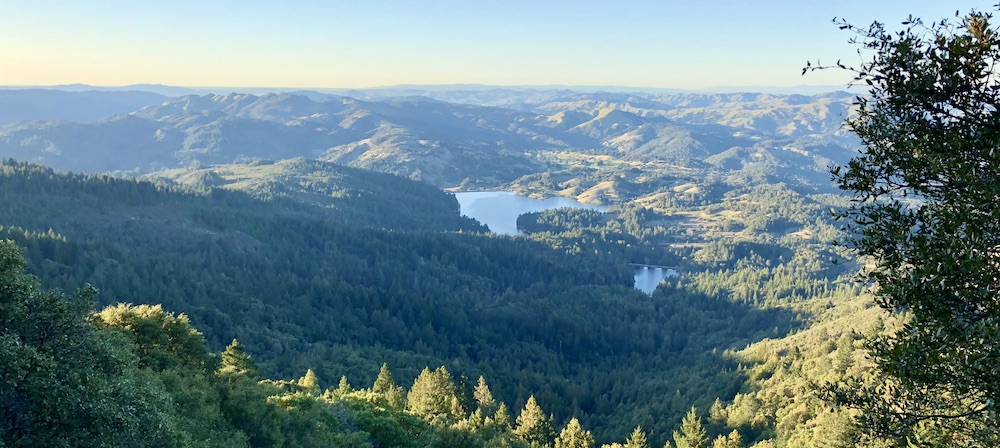
Description: Anticipating a relatively cool day, perfect for this hike, we'll be spending a lot of time just below the cooler ridges of Mt. Tam's peaks. Starting at the Miller Trailhead on East Ridgecrest Blvd., we head west on the Bucket Trail, our first of many non-system trails. We'll make our way, very indirectly, to the 2nd tallest falls on Mt. Tam (no promises on the amount of water), not mentioned on any map. We then begin our gradual uphill through a beautiful unmapped forest. We'll pass Colier Spring, in a stand of ancient redwoods before heading towards the East Peak Summit. From this highest point in Marin County with outrageous views in every direction we can climb to the fire lookout tower on the very top, do the .7 mile wheelchair accessible Verna Dunshee Trail which circumambulates the peak, or neither, depending on the weather. From there we'll start back towards the cars on the trail now called Over Under, formerly called Midget. About 2/3 of the hike will be on non-system trails, all reasonably well-behaved ones! The same percentage goes for the amount of shade. There is one .2 mile uphill on the Redwood Spring Trail that is fairly steep, with plenty of small trees to hold onto along the way. Other than that the whole hike has fairly gradual ups and downs. Dogs are always welcome in the Marin Watershed.
Bring/Wear: Bring plenty of water, lunch, layers for a late spring hike, hat and sunscreen for the sunny portions and hiking poles (always helpful for the ups and downs - especially if the ground is dry).
Rain Policy: Contact the hikeleader if the weather is questionable.
Trailhead Meeting Place: We'll meet at the "Saddle", also known as the "Miller Trailhead". Exit US 101 at the Hwy 1/Stinson Beach off ramp. Turn left at Tam Junction to stay on Hwy 1. Continue for 8 miles until a fork in the road. Keep right to head up towards Mt. Tamalpais and Muir Woods. At the intersection (4 Corners) take the middle option - straight ahead uphill. Continue for ~ 2 miles. You'll see Mountain Home Inn on the right. Continue until the fork across from the Pantoll Ranger station/parking lot. Go up to the right. When you reach the large parking area for Rock Spring, continue up to the right. In 1.9 miles we'll be parking on the right. Please park perpendicular to the road. Google Maps link
Trailhead Meeting Time: 10:00 AM
Trailhead Departure Time: 10:15 AM
Driving Distance to and from SF: 46.5 miles.
Carpool Fees from SF (Incl Bridge): $8; $11 from Rockridge BART.
Level-1
|
Level-2
|
Level-3 |
Level-4 |
Level-5 |
|
easiest
< 5 miles
< 500' gain
|
moderately easy
5-7 miles
< 1000' gain |
moderate
7-9 miles
< 1500' gain
|
strenuous
9-12 miles
< 2000' gain
|
very strenuous
12-15+ miles
>2000' gain |
