
MT. TAM: COASTAL WILDFLOWER HIKE
Leader: Gary Weiss
Leader Email: gary@sfhiking.com
Leader Phone: 415-279-5570
Meeting Date and Day: Saturday, April 1, 2023
Meeting Location (ONLY IF you've arranged for a ride in SF): Whole Foods;
2001 Market St. @ Dolores (on the Dolores St. side); parking on the street or below.
Meeting Time: 9:00 AM, departing shortly afterwards.
Rating: Level 4
Mileage: 9.5 miles
Elevation Gain: 1650'
Description: This hike should take place right in the middle of prime wildflower season. The Coastal Trail is the perfect backdrop for viewing poppies, lupine and dozens of other Spring wildflowers amid astonishing views of the Pacific. Starting at the Quarry parking area we'll pass Mountain Theater on the way to Pantoll Station where we'll catch the Coastal Trail. We'll continue on Coastal for at least 3 miles, passing a 1941 Pontiac just off the trail. Eventually we'll hike up and over West Ridgecrest to get to the Cataract Trail. After a short time on Cataract we'll take one of my (many) favorite trails (Calypso Trail) towards a WWII plane crash, past the Throne, down a portion of the Backside Trail, through Washington Square and down Simmons East. From there we'll take a couple of sneaky trails on our way back to the cars. The majority of the hike will be on system trails with a few short, unofficial odds and ends thrown in for your amusement. The Coastal Trail is entirely in either the Mt. Tamalpais State Park or the GGNRA. Unfortunately dogs are not allowed in either jurisdiction.
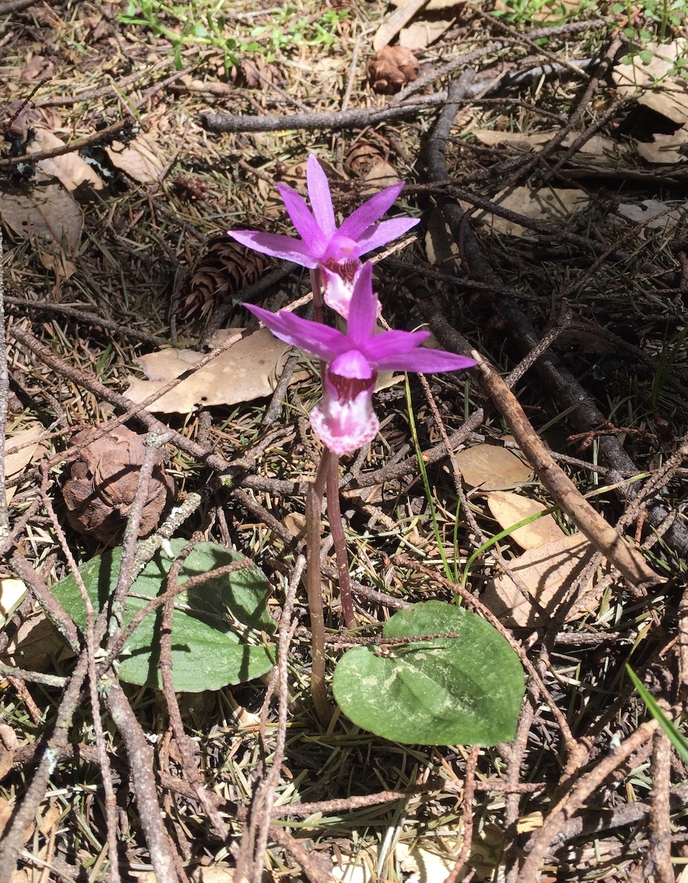 The Calypso Twins
Bring/Wear: Bring plenty of water, lunch, layers for a spring hike, hat and sunscreen for the sunny portions and hiking poles if you use them.
Rain Policy: Contact the hikeleader if the weather is questionable.
Trailhead Meeting Place: We'll meet at Rock Spring Parking Lot.
Exit Hwy 101 at the Stinson Beach/Hwy 1 exit. At the first big intersection - Tam Junction - keep left at the Arco Station to stay on Hwy 1. After several miles you'll reach an intersection where Hwy 1 continues straight ahead. Keep right instead to get onto Panoramic Hwy. At the first big intersection - 4 Corners - go straight up - not down to the left or right. Stay on Panoramic for another 4+ miles. The road forks at Pantoll Ranger Station - stay right onto Pantoll Rd. After less than a mile you'll get to Rock Spring Parking. lot.
Google Maps Link
Trailhead Meeting Time: 10:00 AM
Trailhead Departure Time: 10:15 AM
Driving Distance: 44 miles there and back from SF. 73 miles from Rockridge.
Passenger Carpool Fees from SF: $8; From Rockridge BART: $11
Level-1
|
Level-2
|
Level-3 |
Level-4 |
Level-5 |
|
easiest
< 5 miles
< 500' gain
|
moderately easy
5-7 miles
< 1000' gain |
moderate
7-9 miles
< 1500' gain
|
strenuous
9-12 miles
< 2000' gain
|
very strenuous
12-15+ miles
>2000' gain |
